Satellite view of river Danube over Budapest
Moving the mouse over the bridges you will find a short piece of information about each. Click them for a detailed description.
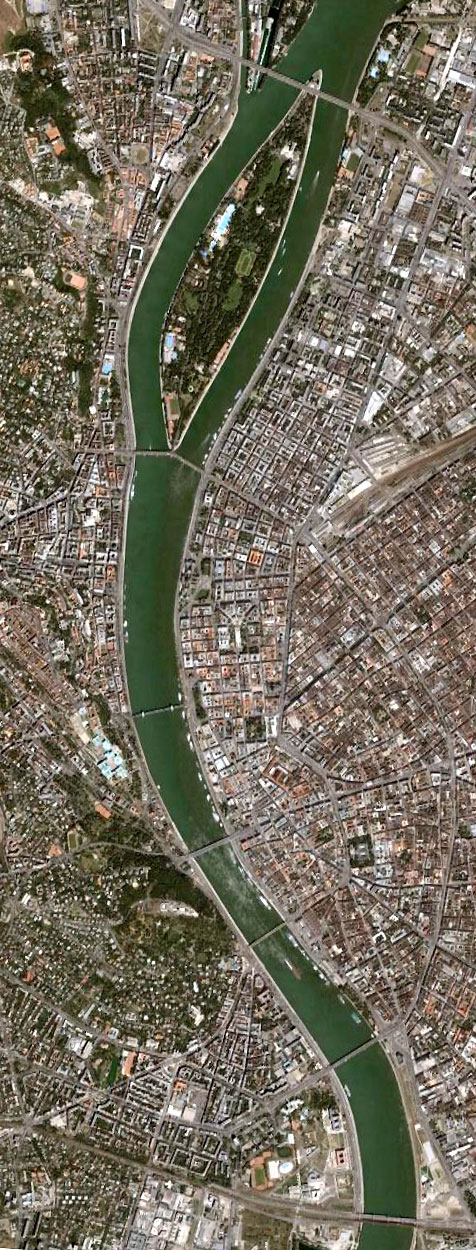
In the first picture you can see the satellite image of Megyeri Bridge spanning Budapest at its most Northern point. The distance between Megyeri Bridge and the other bridges of Budapest is relatively great, that is why they are shown on two separate satellite images. In the second picture the other bridges of Budapest can be seen: Arpad Bridge in the North, Lagymanyosi Bridge in the South, and the remaining five Budapest bridges in between.
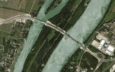
The distance between Megyeri Bridge and Arpad Bridge is about 8-9 kilometers.
BRIDGES OF BUDAPEST
DID YOU KNOW?
Initially, there was no passage from Margaret Bridge to Margaret Island. A new side-bridge leading up to Margaret Island was inaugurated in 1900. Formerly, the distance between bridge and island had been larger. At the end of the 19th century, however, Margaret Island was united with the so-called Painter Island at its southern end.Read more
